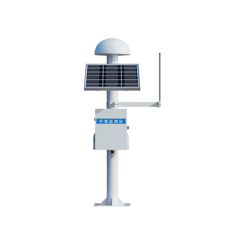
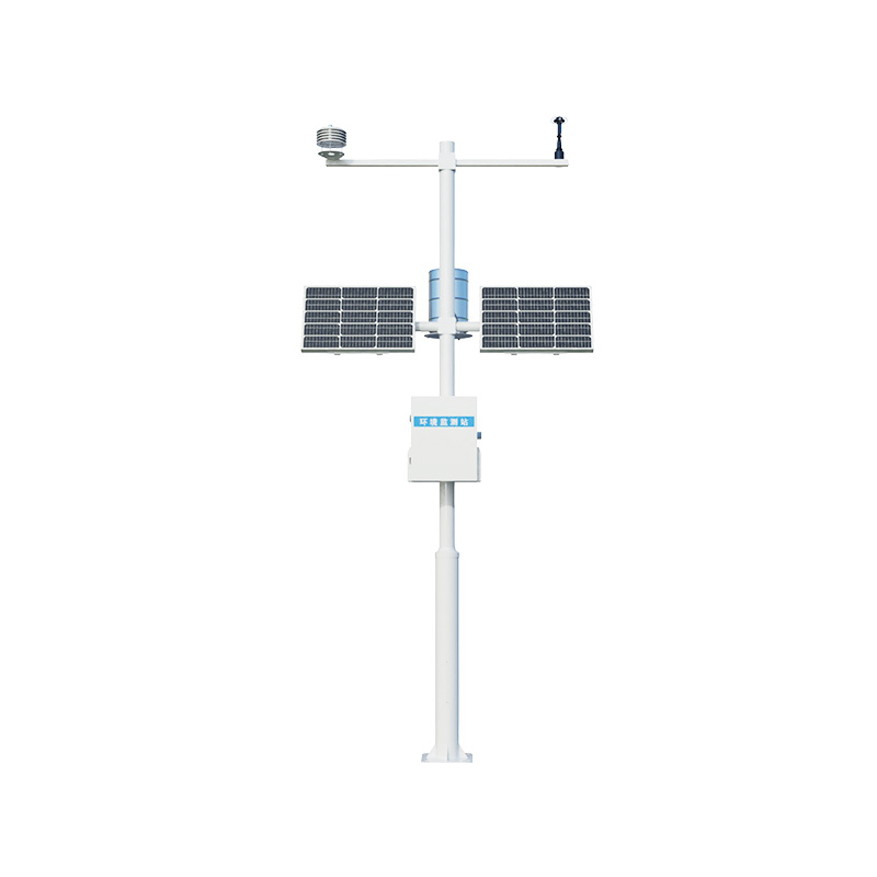
1. Product Introduction
The GNSS displacement station is a product that uses differential RTK
technology to achieve millimeter-level displacement monitoring. It can be widely
used in engineering fields such as dam safety monitoring, bridge health
inspection, and landslide early warning. This product has high precision, high
stability, and real-time data transmission capabilities, and can accurately
monitor the slight displacement changes of the target object in various complex
environments. The GNSS displacement station is easy to operate and install, and
can be remotely monitored and analyzed, providing a strong guarantee for
engineering safety. In addition, its powerful data processing capability and
compatibility allow the product to easily integrate into various monitoring
systems, achieving data sharing and integration, and providing a comprehensive
and efficient solution for engineering safety monitoring.
2. Product parameters
Sensor parameters:
1. Sensor power supply: DC10V-15V
2. Sensor power consumption: 0.25W
3. Static accuracy (differential mode): Horizontal ± (2.5 mm + 1 ppm),
Vertical ± (5 mm + 1 ppm)
4.☆Antenna: Choke coil antenna, magnetic microwave absorption material,
effectively reduce multipath effect
5.☆ Communication protocol: Modbus-RTU, support device end offline
calculation of displacement, vertical and horizontal direction of
displacement.
6. Support RTCM3差分 data
7. Size: diameter 360mm height 163mm
8. Working environment: -40°C~+85°C, 0%RH~95%RH (no dew)
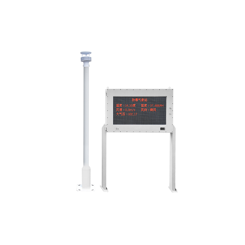
Monitoring station parameters:
9. Station power supply: 30W solar panel, 20AH battery
10. Station power consumption: sensor + LORA: 0.6W sensor + LORA + data
upload: 0.96W
11.☆Support for displacement alarm, displacement output, and displacement
angle output in independent operation mode (without dependence on the cloud
platform)
12. Support 4G, wireless bridge, wifi, Ethernet and other data communication
transmission
13.☆Support TCP, HTTP, UDP direct transmission of the station to the customer
platform
Collector parameters:
14.☆Support for on-site RS485 output of ASCII data format
15.☆Support for on-site addition of RS485Modbus-RTU environmental sensors
16. Built-in 4GFPC antenna support
Cloud platform parameters:
17.☆Support platform forward support TCP, HTTP
18.☆Cloud platform supports 3D data viewing, intuitively view the
displacement direction and change amount of the observation point
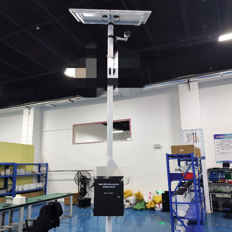
Three, Product Installation
Installation requirements:
1. Neither the reference station nor the survey station should be surrounded
by tall buildings, and if it is impossible to avoid them, they should be at
least 20 meters away from them.
2. The distance (基線 distance) between the reference station and the measuring
station is recommended to be less than 500 meters, and should not exceed 2KM. It
is also important to install at the same altitude as much as possible. A large
distance will lead to a decrease in accuracy.
3. The baseline and the measuring station should be as visible as possible,
and if full visibility is not possible, it is important to avoid any tall walls
or buildings that could block the line of sight.
4. Ensure that the satellite antenna is the highest point within 20
meters.
5. The mounting base should be firmly secured to avoid accuracy loss due to
wind.
6. Specific installation issues can also be contacted with the company's
after-sales video guidance.
Precautions: GNSS displacement monitoring is a high-precision displacement
monitoring technology that uses positioning satellites such as Beidou and GPS.
The monitoring accuracy of this technology strongly depends on the relative
relationship between the reference station and the monitoring station and the
electromagnetic environment. A too long baseline distance will seriously affect
the monitoring accuracy or even make the data invalid (for example: for a
baseline distance of more than 2KM or even 10KM, the possible displacement
accuracy may be reduced to the 10 cm level due to the influence of the
electromagnetic environment and terrain, which is invalid for displacement
monitoring). Therefore, in order to ensure the accuracy of the measurement, the
recommended baseline distance is within 500 meters.
Product address:
http://m.25561.cn/en/GNSS/1553.html 


 Home
Home phone
phone Product Overview
 Contact Us